Procedural Modelling with Unreal Engine and City Engine
Immersive experience in the diverse landscapes of farmlands, woods and suburban areas in Unreal Engine. - Tran Tran
Download HereKey Features
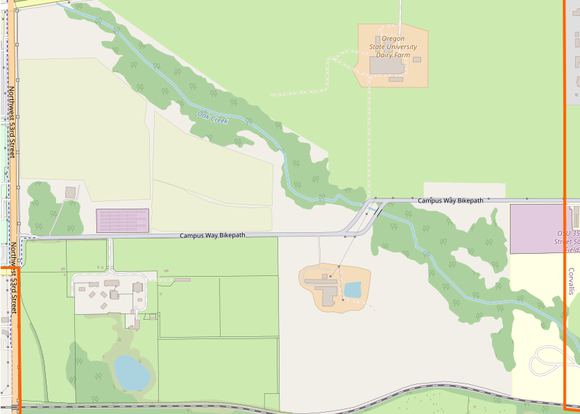
This project aims to integrate Geographical Information System (GIS) to build a 3D virtual environment in Unreal Engine. The chosen model area is in Corvallis, Oregon (see map), selected for its diverse landscapes —including natural areas (grasslands, woodlands, scrub), land uses (farmland, farmyards), and suburban housing. The ultimate goal is to showcase the integration workflow as a case study of the integration of GIS and Graphics to motivate further research and use cases in building the digital twin.
Real-World Reconstruction
The simulation environment is reconstructed from real-world geographic data sourced from OpenStreetMap. From OpenStreetMap, we are able to retrieve a colleciton of shape boundaries to identify geographic areas associated with its feature attributes such as land uses, height, shape type to populate the virtual environment with 3D assets and layout that reflect its real-world layout. This data-driven approach ensures that the environment is both believable and scalable, enabling rapid generation of suburban areas without compromising on realism or detail.
Procedural Content Generation
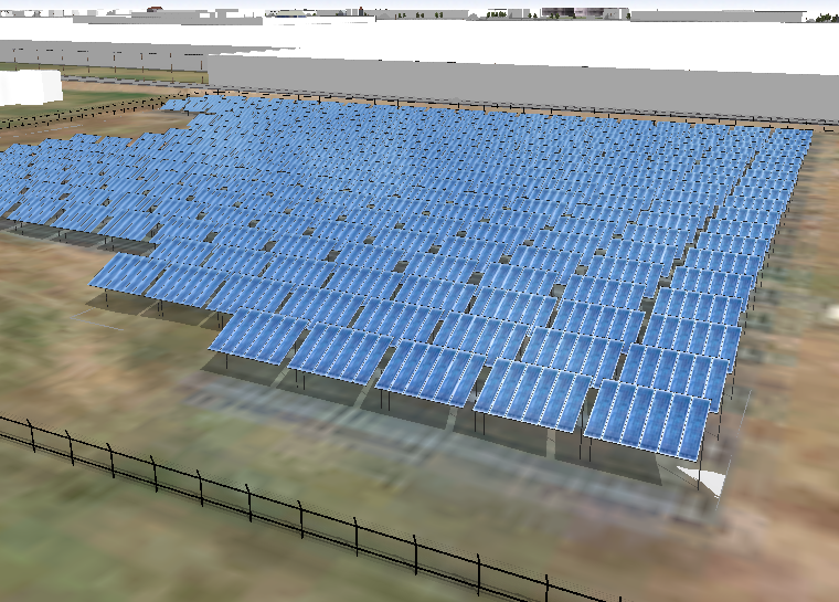
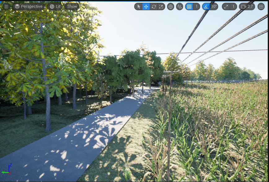
From suburban houses, powerlines to a vast areas of farmlands, woods, the environment is built using rule-based procedural modeling, allowing streets, houses, fences, and infrastructure to be automatically generated dynamically. This approach minimizes manual design work, speeds up iteration, and ensures consistent, scalable worldbuilding across large areas
Technical Workflow
The project integrates two primary data layers: (1) Geospatial Data from OpenStreetMap (OSM), which includes 2D boundary and attribute data; (2) 3D Procedural Content, generated using a combination of CityEngine and Unreal Engine’s PCG (Procedural Content Generation) plugin.
1. Procedural Modelling in CityEngine
CityEngine is a ArcGIS application specializing in the generation of ubban environments It provides both manual drawing tool and procedural tool for city modelling with diverse compatibility with other applications such as 3D modelling application: Blender, or Web visualization (arcgis), or game engines (Unreal Engine, Unity). It uses a robust library of CGA rule packages to automate 3D asset generation.
a) Importing 2D GIS Data
GIS data from OSM is imported as two types:
- Shapes representing buildings, land uses, parking zones, etc.
- Graphs representing roads and linear infrastructure (e.g., fences, powerlines).
b) Generating 3D Content with CGA
CityEngine has its own unique programming language called CGA (Computer Generated Architecture). CGA rules use geometry operation to transform the shape, manipulate the shape, or apply textures to provide a rich, detailed 3D models. CGA rules are defined in rule packages (.rpk) alongside with 3D object files, and texture files referenced
Writing a CGA rule file: Suburban House Modelling
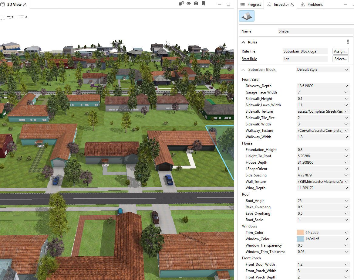
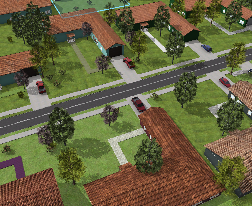
A suburban house model features an L-shaped structure, with one longer wing housing the garage, which faces the street. The garage connects to a driveway that extends directly to the street. The driveway is extruded and slightly inclined upward to match elevation changes or grading. Each house is fronted by a sidewalk running parallel to the street, typically accompanied by a lawn or green buffer that separates the house from the roadway. From the driveway, a walkway leads to the front door, cutting through the front yard and providing a clear pedestrian path from the street to the home’s entrance.
Integrate street attributes to House Generation
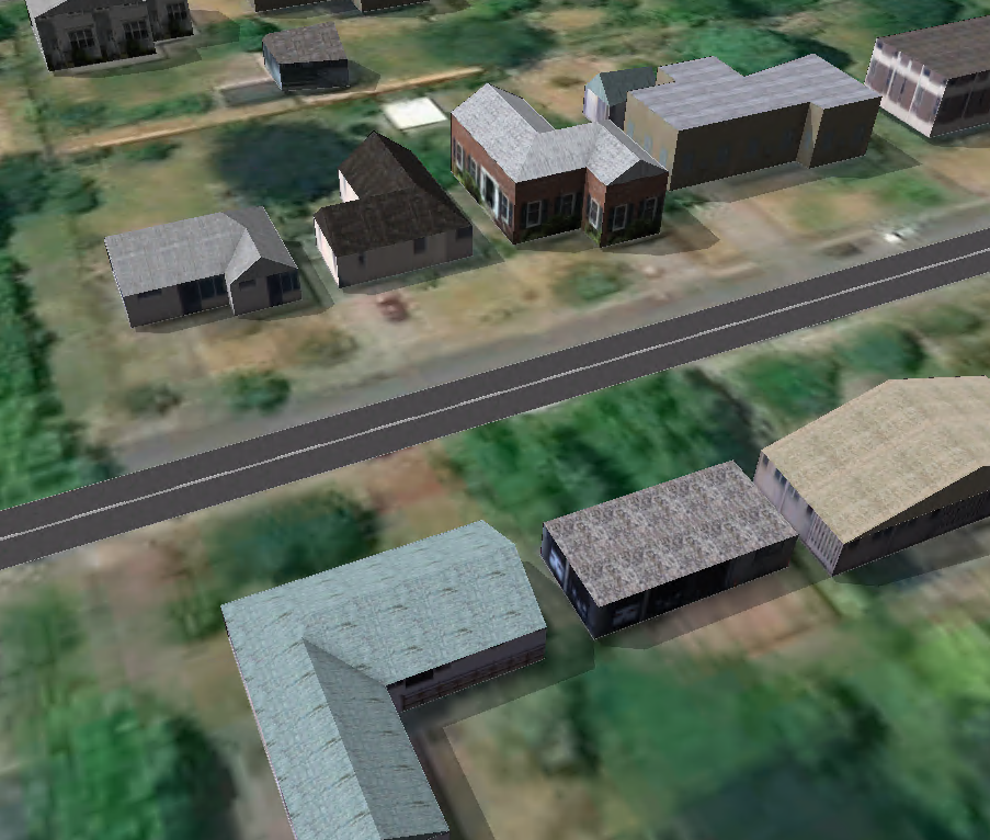
In CityEngine, the graph network not only generate street shapes but also subdivide lots enclosed by the street network. Here, this method is used to model residental areas where each lot is assigned the CGA rule files. Comparing with the traditional method of house generation from OSM building footprint (Figure 1), the lot subdivision method subdivide each lots and tags them with street facing attributes to identify the house orientation, thus enable the generation of driveway and sidewalk connected from the house to the street

Modifying exisitng CGA rule files
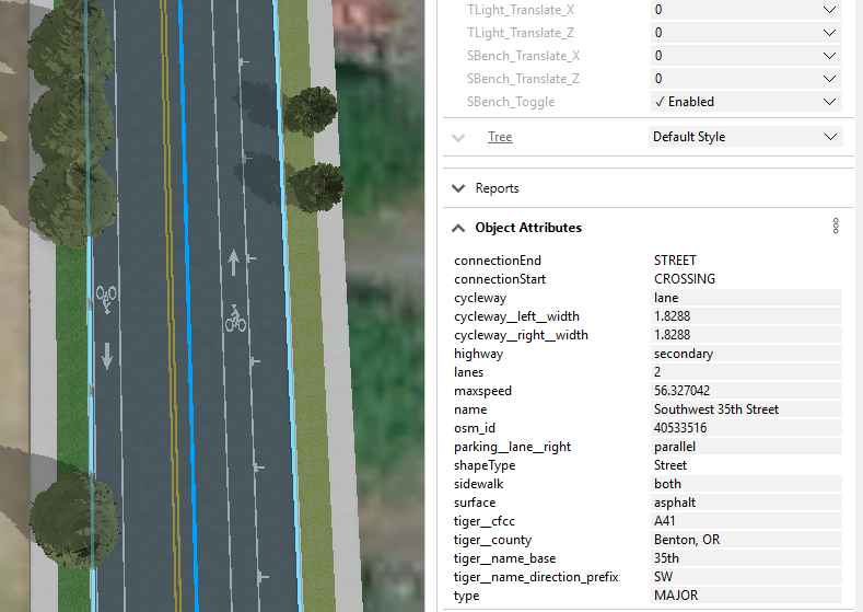
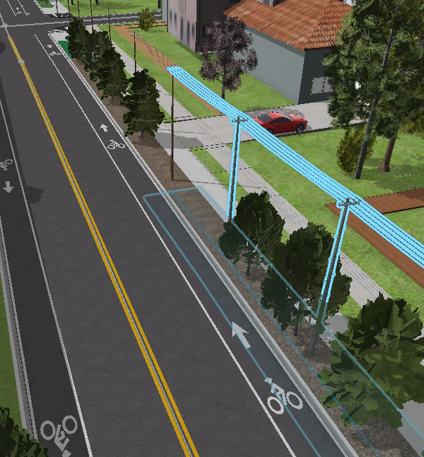
Street Modelling
From the street attribute, the street shape's width is calculated from the number of lanes, cycleway lanes, and parking lanes side. Then Complete Street rule package are assigned to the Street to generate streets and sidewalks based on number of lands, street direction, cycleway, and parking attributes.
Source: Wasserman, D. Complete Street Rule. (2015)GitHub repository
2. Procedural Content Generation in Unreal Engine
a) Importing CityEngine Models
CityEngine Models are imported into Unreal Engine using the Datasmith plugin. This process retains all object attributes by storing them as Asset User Data. These attributes are then converted into tags, which can be used as filters in the Procedural Content Generation (PCG) workflow
b) PCG Workflow
Separate PCG Graphs are created for each landscape type, such as wood, farmland, grass, meadow, and road. Each PCG Graph performs the following steps:
-
World Ray Hit Query
Perform a raycast (World Ray Hit) on actors tagged with the appropriate landscape type (e.g.,wood,grass) to find valid placement surfaces. -
Point Sampling
Generate points on the hit surfaces using parameters such as:- Looseness: controls spacing irregularity between points
- Point Extents: the area each point affects
- Point Density: how many points are generated (e.g., higher density for woods)
-
Project Points onto Terrain
Align generated points to the terrain surface to ensure elevation and slope accuracy. -
Apply Random Offsets, Scales, and Rotations
Introduce variation to each point to prevent visual repetition and achieve natural distribution. -
Spawn Static Meshes
Instantiate a diverse set of static meshes (e.g., trees, shrubs, rocks) according to the landscape type.
Future Enhancements
Dynamic PCG Workflow
- Streamlined PCG Attachment: The PCG attachment and tagging process can be streamlined to be more robust and automated, such as by including only useful tag filters or attaching PCG components automatically.
- Diverse Landscape: Each landscape can be populated with a wider range of vegetation, crops, and ground features.
- PCG connection to the environment: Road realism can be enhanced with grass on the side; and each landscape area can be designed to blend smoothly into the next or into the road
Suburban house Rule Package
- Corner Lot Handling: The current CGA rule for suburban houses does not support lots located at street corners, where there are multiple street-facing edges. At a corner lot, houses typically have sidewalks wrapping around the corner and are set farther back from the street, often with added fences or plantings.
- Expanded House Shapes: Additional house shapes with diverse door generation and placement can be modeled to avoid repetiton and improve realism.
Powerline Rule Package
Continuous powerline generation at CROSSING/JOINT: At these nodes, the rule should switch to using an intersection pole. For diagonal nodes, the orientation of the pole and the stretching of the wires should be dynamically encoded to close any gaps between the wire and the pole.